


Contact Info
Park Falls, WI 54552
- Phone 1:
- 715-362-1371
- Phone 2:
- 715-762-2461
Basics
- Length:
- 9 miles
- Difficulty:
- Intermediate
- Time:
- 4 - 5 hours
Description
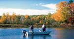
This trail traverses some hilly terrain and offers good hiking and mountain biking opportunities, as well as being groomed for cross-country skiing (traditional). It includes three loops with one loop for beginning skiers. Five walk-in campsites are located around Lauterman Lake complete with tables, tent pads, fire rings, and wilderness-style toilets. If the fish are biting, you may find yourself hooking northern pike, bass, perch, and panfish. An added feature is an Adirondack-style shelter that provides a rest or picnic stop for hikers and skiers alike. This trail connects with Perch Lake to the north and the Pine River and Chipmunk Rapids Campground to the south. A trail map is available at the trailhead.
Other trails connected to this system are the Perch Lake Trail, Ridge Trail, and the Assessor's Interpretive Trail.

