


Contact Info
Federal Building, Room 159
Carlsbad, NM 88220
- Phone:
- 575-885-4181
Basics
- Length:
- 1 mile
- Difficulty:
- Intermediate
- Time:
- 30-45 mins
Description
Turn south on FR540 for 11.4 miles to FR3008.
If you do not have an ATV, motorcycle, or high clearance 4-wheel drive vehicle, park at the intersection of FR540 and FR201 (end of graveled road) and continue on foot.
Otherwise, continue south and east on FR3008 for approximately two miles to Camp Wilderness Ridge Trailhead. Vehicles and ATVs are not allowed past this point, where the trail becomes single-track.
T45 is a single-track trail off the end of FR3008, which continues for approximately one mile on National Forest Service system land.
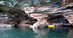
The trail then crosses the New Mexico and Texas State line into Guadalupe Mountains National Park. The trail continues for an additional 5 miles as the Permian Reef Trail, terminating at the McKittrick Canyon Visitor Center.
The Permian Reef Trail is non-motorized and non-mechanized on National Park Service land.
The hike is easy to the District boundary, where it overlooks McKittrick Canyon. It becomes a steep descent as the Permian Reef Trail.

